
|
Getting your Trinity Audio player ready...
|
According to several local and international media reports, a fire razed the Kantamanto market on Thursday, January 2, 2025. Located within the central business district of Accra, the market is at the heart of Ghana’s informal economy. It receives nearly 15 million garments from outside the country every week, making it one of the largest used clothing markets in West Africa.
The fire reportedly destroyed about 100 shops, and some affected traders estimated the loss to be hundreds of thousands of cedis.
ACFO II Rashid Kwame Nasawu, the Accra regional fire commander, reported in an interview with TV3 Ghana that the fire started at 01:18 a.m. with the first fire tender arriving on site by 1:20 a.m.
“The fire started at 01:18 hours, and by 01:20, the first tender was here from Accra city. The fire is under control. We have been able to salvage the Commercial Band [and] other adjoining buildings surrounding the Kantamanto market. At the moment, salvaging is ongoing, so after salvaging, we will be able to tell how many stalls have been destroyed… We have not registered any casualty,” he said.
Based on data gathered by the US government’s National Aeronautics and Space Administration’s (NASA) Visible Infrared Imaging Radiometer Suite (VIIRS), active fire was detected within the Kantamanto area from space at about 1:19 am, which corroborates the claim of the regional fire commander.
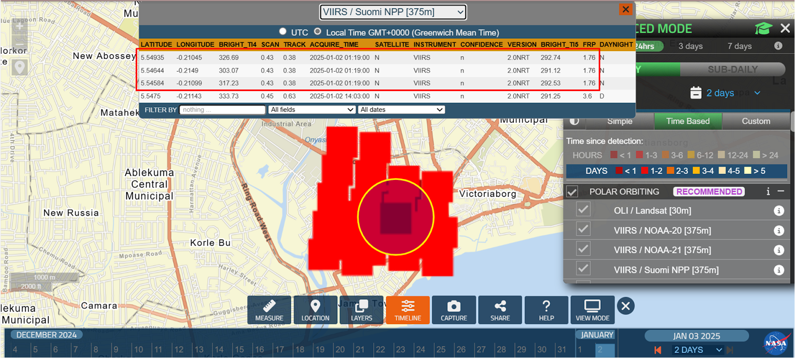
NASA Fire Information for Resource Management System confirms that the fire started around 1:16 am
Based on the FRP data – data showing the rate of energy emission per time unit from the area, the fire was first detected around 1:19 AM with a relatively low intensity of 1.79MW. At 1:41 AM, a significant increase in RFP occurred. The intensity reached 9.39MW, which suggests a potential explosion. While this pattern strongly supports the idea of an explosion, other factors, such as fire spread or environmental conditions, could also contribute.
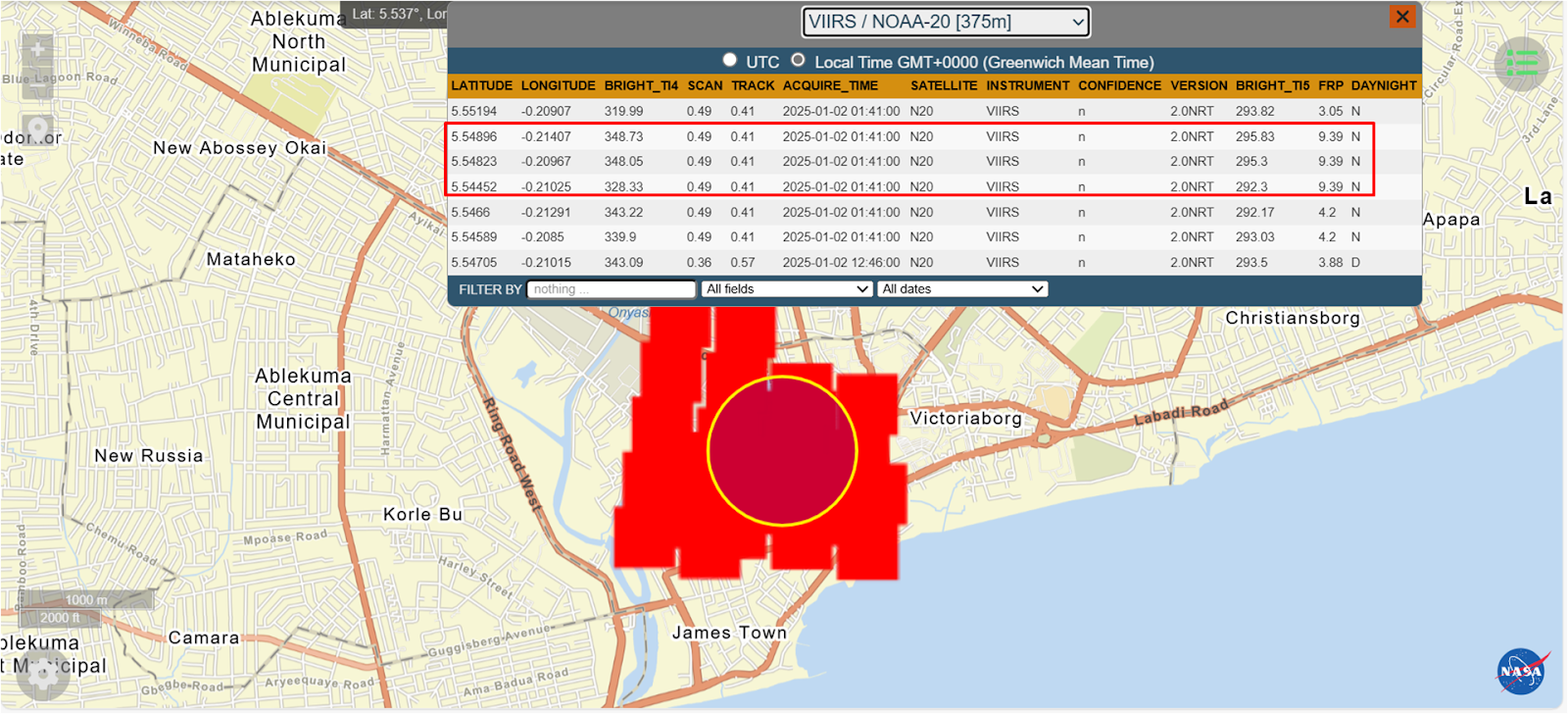
NASA Fire Information for Resource Management System records heightened intensity at 1:41 am.
Using Channel One TV’s viral aerial photograph of the ruins after the fire, we located the worst affected area of the market to view how the area looked before the fire. We identified coordinates as 5°32’51″N 0°12’41″W.

Before the fire outbreak. Credit: Google Earth
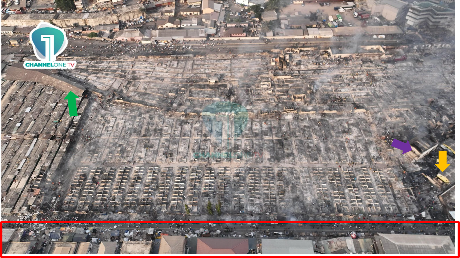
After the fire outbreak. Credit Channel One TV
After analysing the photos before and after the fire, we discovered that the claims that 100 stores were affected by the fire had been significantly understated.
The cause of the fire is not yet clear. While some suggest arson, there is no concrete evidence to confirm it. The GNFS has begun an investigation to ascertain the true cause of the fire.


